- Products ProductsLocation Services
Solve complex location problems from geofencing to custom routing
PlatformCloud environments for location-centric solution development, data exchange and visualization
Tracking & PositioningFast and accurate tracking and positioning of people and devices, indoors or outdoors
APIs & SDKsEasy to use, scaleable and flexible tools to get going quickly
Developer EcosystemsAccess Location Services on your favorite developer platform ecosystem
- Documentation
- Pricing
- Resources ResourcesTutorials TutorialsExamples ExamplesBlog & Release Announcements Blog & Release AnnouncementsChangelog ChangelogDeveloper Newsletter Developer NewsletterKnowledge Base Knowledge BaseFeature List Feature ListSupport Plans Support PlansSystem Status System StatusLocation Services Coverage Information Location Services Coverage InformationSample Map Data for Students Sample Map Data for Students
Inspect Interactive Map Layers
Interactive map layers (IMLs) are optimized for GIS functions - visualization, analysis, and modification of data on a map. Unlike other layer types, the data in an IML is not tiled, is stored in GeoJSON, and can be retrieved dynamically at any zoom level. For more information on IMLs, see the Data User Guide.
With the Data Inspector, you can do the following:
-
Visualize IML data in the Map View. No tile grid is available for IMLs, and the layer data is visualized right away. Note that if the GeoJSON contains style properties, those are used for visualization.
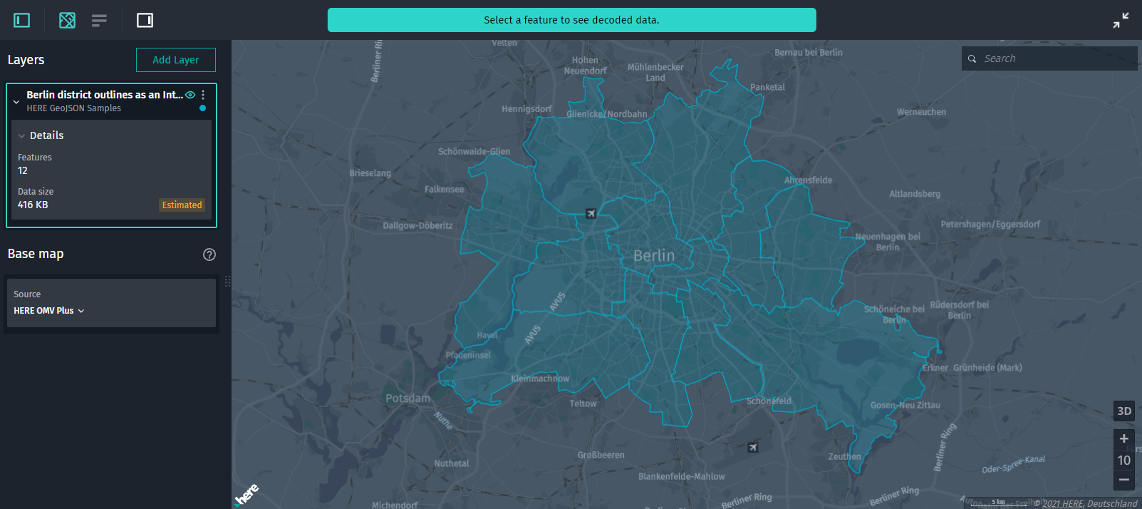
Figure 1. Visualization of Berlin districts -
Inspect feature details. Click a feature to view its details in the Infopanel and in the Decoded data panel.
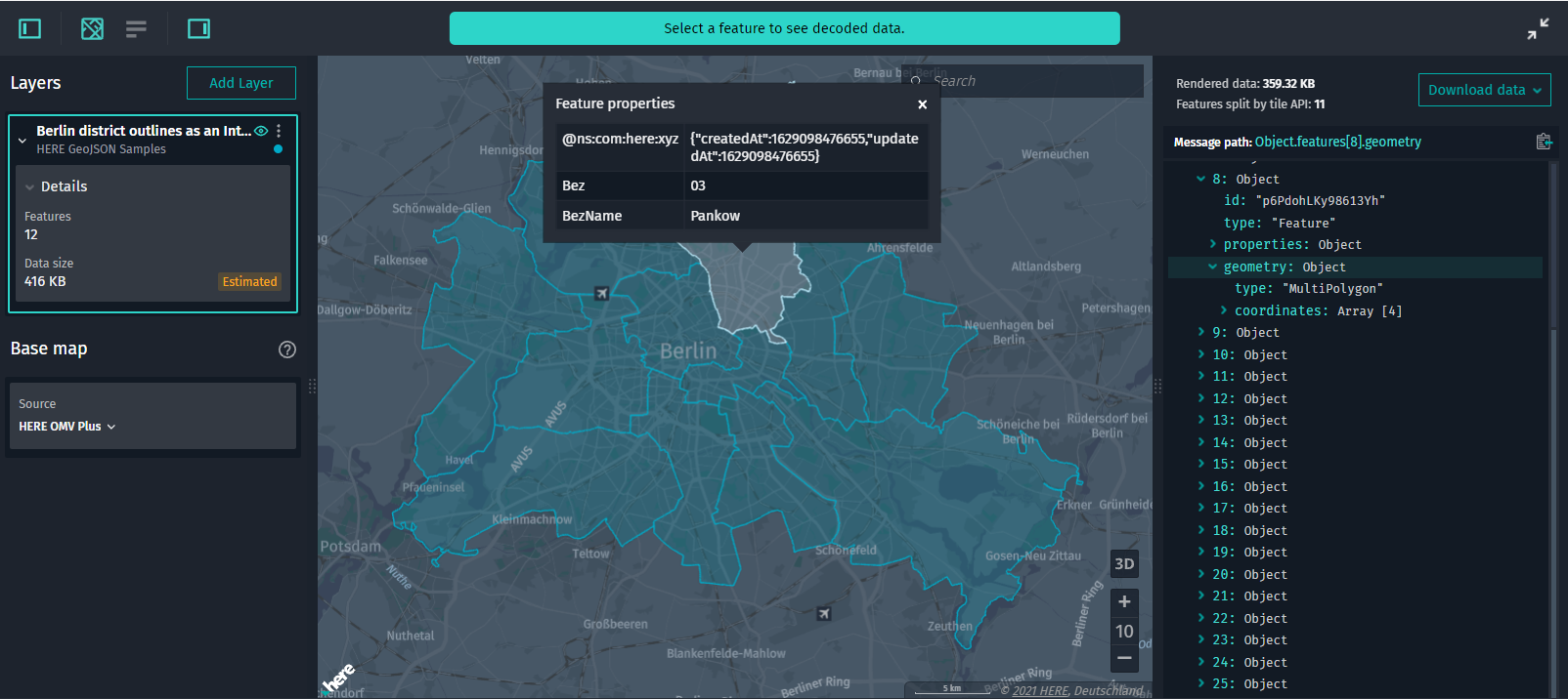
Figure 2. Feature details -
View layer details. In the Control Panel, in the layer details section, you can view the data size of the entire layer and the number of features stored in the layer.
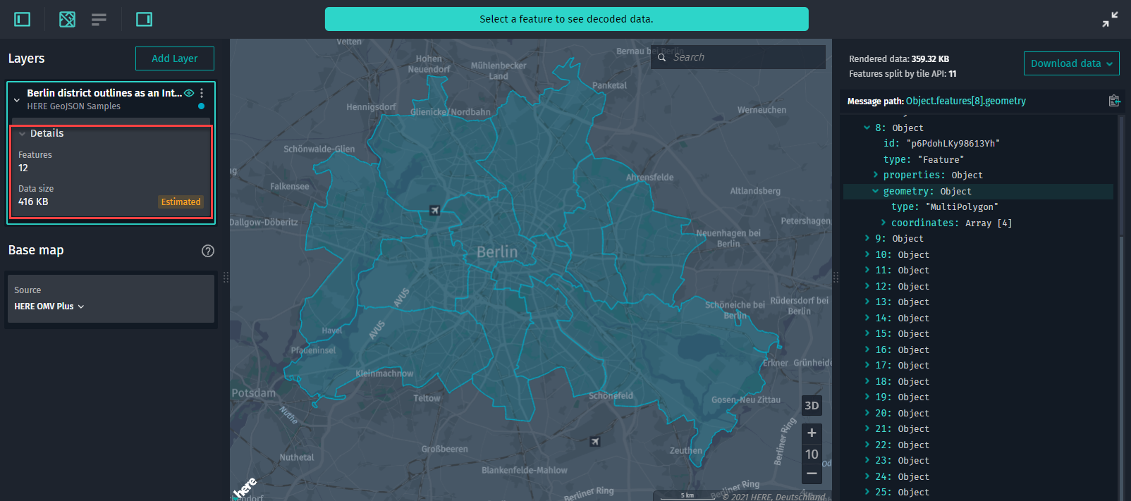
Figure 3. IML details -
View details on the rendered data currently visible in the Map View. In the Decoded Data panel, you can additionally do the following:
- View the size of the data rendered in the Map View.
-
View the number of unique features clipped by the API rendered on the map since some features can be tiled (even though visually the geometry is merged):
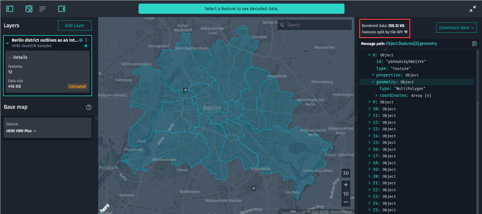
Figure 4. Features clipped by the tile API
-
Look up features. Apart from regular search options (by coordinates, locations, place names), you can search for a particular feature by its ID, for example,
0JHbJof1n2iTqhno.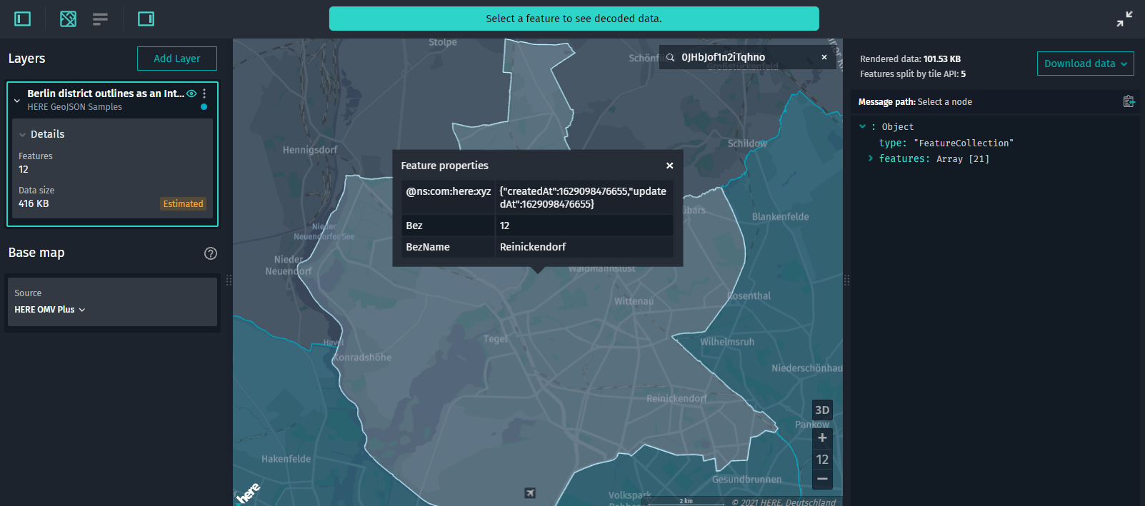
-
Download IML data. Either right-click anywhere in the Map View or click Download in the Decoded Data panel to download the GeoJSON data.
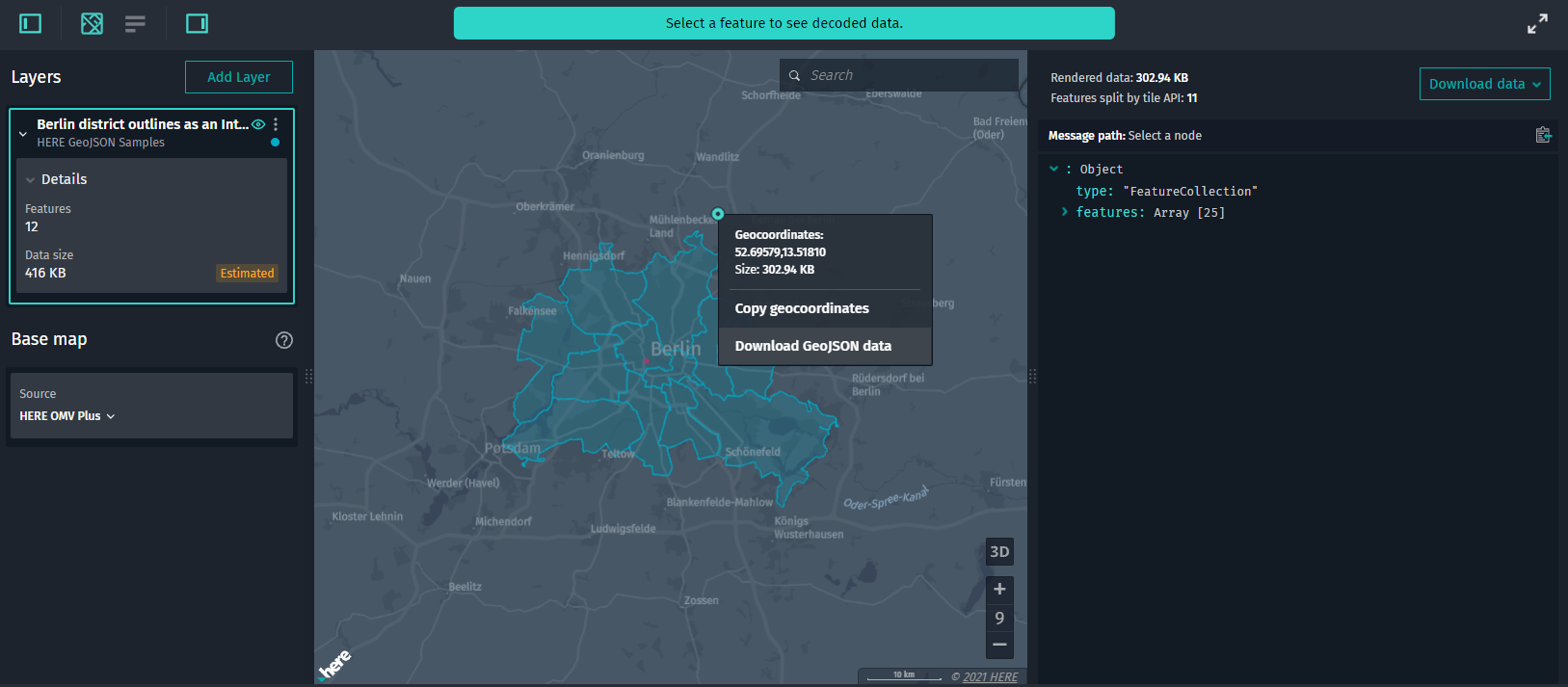
Figure 5. IML download
Note
The Partitions List panel is disabled for interactive map layers.